El Nino Pacific phenomenon arrives
El Nino Pacific phenomenon arrives
Bureau of Meteorology announces El Nino arrival
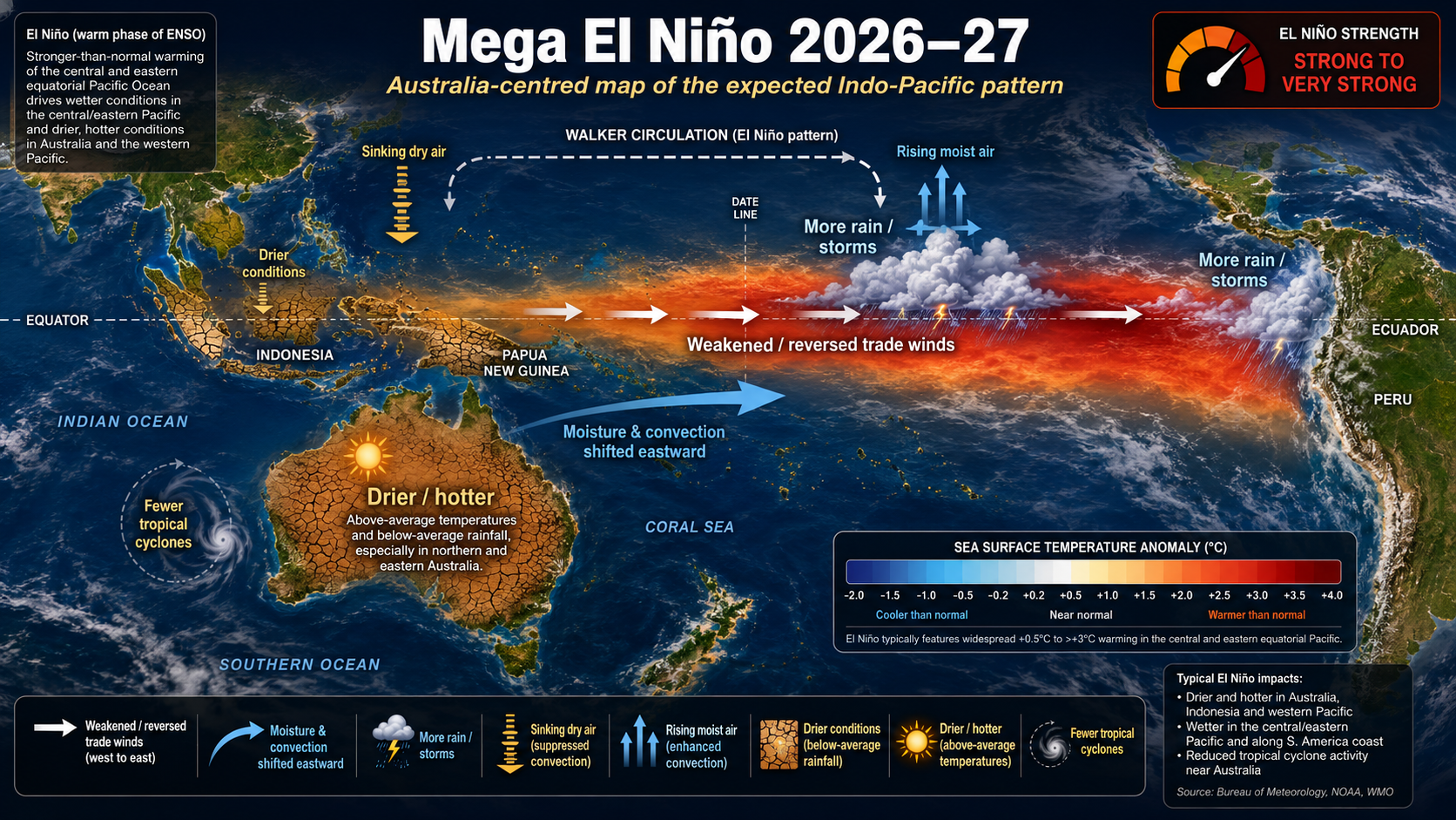
On July 16th, the Bureau of Meteorology announced that the Pacific weather phenomenon called El Nino has arrived. This has been expected for some time and is expected to cause significant changes to weather in Queensland.
The basics
What is El Nino?
- A period when sea surface temperatures are higher than usual
- It tends to last for up to 12 months
- This event occurs every 3-4 years
- The last El Nino was in 2023
Local effects
What it does to Australia?
Australian weather is affected quite a lot by El Nino because it cuts off a cycle that brings moist air and rainfall. El Nino can cut off this cycle entirely, redirecting clouds and rain away from Australia. Cutting off this cycle also increases average air pressure and higher air pressure leads to more stable weather conditions.
The measurements
A record-breaker
This El Nino is also one of the strongest in recorded history. This is according to a special scale that is used to monitor it. It measures sea surface temperatures and the higher they are above average, the stronger El Nino. This year, El Nino is in the very highest category which means it’s effects will be stronger than usual.
Looking ahead
Weather predictions
So we know what El Nino is and what it does but what does all that actually mean? Well, first of all we can expect less clouds and rain this winter. Second, the winter is expected to be hotter than usual with higher daytime temperatures and lower nighttime temperatures. Colder nights also means increased frost. Because of the lack of rainfall, we can also expect a longer bushfire season.